
284 IEEE GEOSCIENCE AND REMOTE SENSING LETTERS, VOL. 14, NO. 3, MARCH 2017
GA-SVM Algorithm for Improving Land-Cover
Classification Using SAR and Optical
Remote Sensing Data
Chanika Sukawattanavijit, Jie Chen, Member, IEEE, and Hongsheng Zhang, Member, IEEE
Abstract— Multisource remote sensing data have been widely
used to improve land-cover classifications. The combination
of synthetic aperture radar (SAR) and optical imagery can
detect different land-cover types, and the use of genetic algo-
rithms (GAs) and support vector machines (SVMs) can lead to
improved classifications. Moreover, SVM kernel parameters and
feature selection affect the classification accuracy. Thus, a GA was
implemented for feature selection and parameter optimization.
In this letter, a GA-SVM algorithm was proposed as a method
of classifying multifrequency RADARSAT-2 (RS2) SAR images
and Thaichote (THEOS) multispectral images. The results of
the GA-SVM algorithm were compared with those of the grid
search algorithm, a traditional method of parameter searching.
The results showed that the GA-SVM algorithm outperformed
the grid search approach and provided higher classification
accuracy using fewer input features. The images obtained by
fusing RS2 data and THEOS data provided high classification
accuracy at over 95%. The results showed improved classifi-
cation accuracy and demonstrated the advantages of using the
GA-SVM algorithm, which provided the best accuracy using
fewer features.
Index Terms— Genetic algorithms (GAs), image fusion,
land-cover classification, multisource data, optical imagery,
support vector machine (SVM), synthetic aperture
radar (SAR).
I. INTRODUCTION
T
HE fusion of synthetic aperture radar (SAR) and optical
images is one of the most important processes in land-
cover classification. Cu rrently, the availability of up-to-date,
multisource remote sensing and crop typ e data are important
for improving land-cover classifications. In Thailand, optical
data are often limited by cloud cover. Thus, the main advantage
Manuscript received March 21, 2016; revised July 13, 2016, September 5,
2016, and Nov e mber 4, 2016; accepted Nov e mber 9, 2016. Date of publication
January 24, 2017; date of current version February 23, 2017. This work w as
supported in part by the Geo-Informatics and Space Technology Development
Agency, and in part by the National Natural Science Foundation of China
under Grant 61132006.
C. Sukaw attanavijit is with the School of Electronics and Information
Engineering, Beihang University, Beijing 100191, China (e-mail:
chanikawat@hotmail.com).
J. Chen is with the Collaborativ e Innovation Center of Geospatial
Technology, Wuhan 430079, China, and also with the School of Electronics
and Information Engineering, Beihang Univ e rsity, Beijing 100191, China
(e-mail: chenjie@buaa.edu.cn).
H. Zhang is with the Institute of Space and Earth Information
Science, The Chinese University of Hong Kong, Hong Kong (e-mail:
stevenzhang@cuhk.edu.hk).
Color versions of one or more of the figures in this letter are available
online at http://ieeexplore.ieee.org.
Digital Object Identifier 10.1109/LGRS.2016.2628406
of SAR is the all-weather capability of these systems. In opti-
cal systems, information obtained from the electromagnetic
spectrum depends on the reflection and emission properties of
the earth’s surface, whereas the SAR backscatter coefficient is
measured using the structural and dielectric p roperties of the
target surface. The combination of optical and SAR data can
be applied to improve land-cover mapping, as has been shown
in several studies [1], [2].
Support vector machines (SVMs) embody a number of
theoretical machine-learning concepts. I nitially, SVMs were
developed w ith the investigation capabilities and capacity
control of machine learning and used formalization to solve
overfitting p ro blems in high-dimensional feature spaces [3].
SVMs are able to minimize so-called structural risks when
determining classification errors. SVMs use maximum likeli-
hood techniques that empirically reduce the misclassification
problem, which is directly defined by the distribution of
training sets. Presently, SVMs are related to the nonparametric
supervised classification method, which has been demonstrated
to be a robust method and h as been adopted in the field of
pattern recognition and machine learning. Moreover, SVMs
have been widely employed in many studies using remotely
sensed imagery [4]–[7].
The optimal feature subset and parameter settings are
important factors for improving SVM classification. In this
letter, the SVM approach with radial basis function (RBF)
kernel p arameters was applied to classify land cover [8 ].
Two parameters were optimally identified to achieve the best
accuracy: the penalty parameter C and the kernel function
width γ . Grid search is the traditional method of finding the
proper C,andγ is then applied. However, this technique is
time intensive, and is difficult to manage. Furthermore, the
grid search approach cannot simultaneously process feature
subset selection and SVM p arameter optimization.
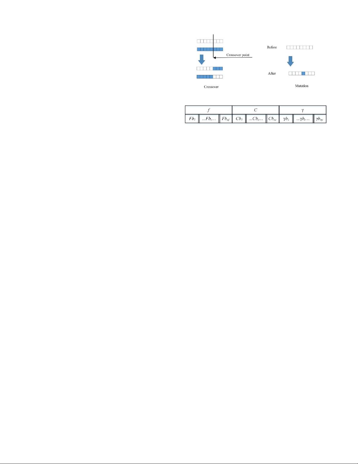
Genetic algorithms (GAs) can simultaneously identify
the optimal feature subset and the SVM kernel parame-
ters without decreasing the accuracy of the SVM classi-
fication. GAs were first proposed to optimize the para-
meter and feature selection for SVM classifiers in several
studies [9], [10]; however, these letters did not address
the combination of optical and SAR data. Moreover, the
GA-SVM algorithm has been widely employed in a num-
ber of studies, including medical studies [11], financial
data analyses [12], and biological studies [13]. Therefore,
the objective of this letter is to determine the optimal
1545-598X © 2017 IEEE. Personal use is permitted, but republication/redistribution requires IEEE permission.
See http://www.ieee.org/publications_standards/publications/rights/index.html for more information.