运河衬砌在地下水波动中的作用:Jahawala分水厂,Bahawalnagar的建模模拟方法
3 浏览量
2020-06-04
19:03:27
上传
评论
收藏 9.9MB PDF 举报


Open Journal of Applied Sciences, 2017, 7, 213-232
http://www.scirp.org/journal/ojapps
ISSN Online: 2165-3925
ISSN Print: 2165-3917
DOI: 10.4236/ojapps.2017.75019
May 31, 2017
Role of Canal Lining on Groundwater
Fluctuations: A Modeling Simulation Approach
for Jaalwala Distributary, Bahawalnagar
Muhammad Hammad Atique Khan
1
, Muhammad Usman Saleem
2
, Sajid Rashid Ahmad
2
,
Nasir Ahmad
1
, Shahid Jamil Sameeni
1
, Muhammad Akram
3
, Muhammad Farooq
3
1
Institute of Geology, University of the Punjab, Lahore, Pakistan
2
Collage of Earth and Environmental Sciences, University of the Punjab, Lahore, Pakistan
3
Irrigation Department, Government of Pakistan, Lahore, Pakistan
Abstract
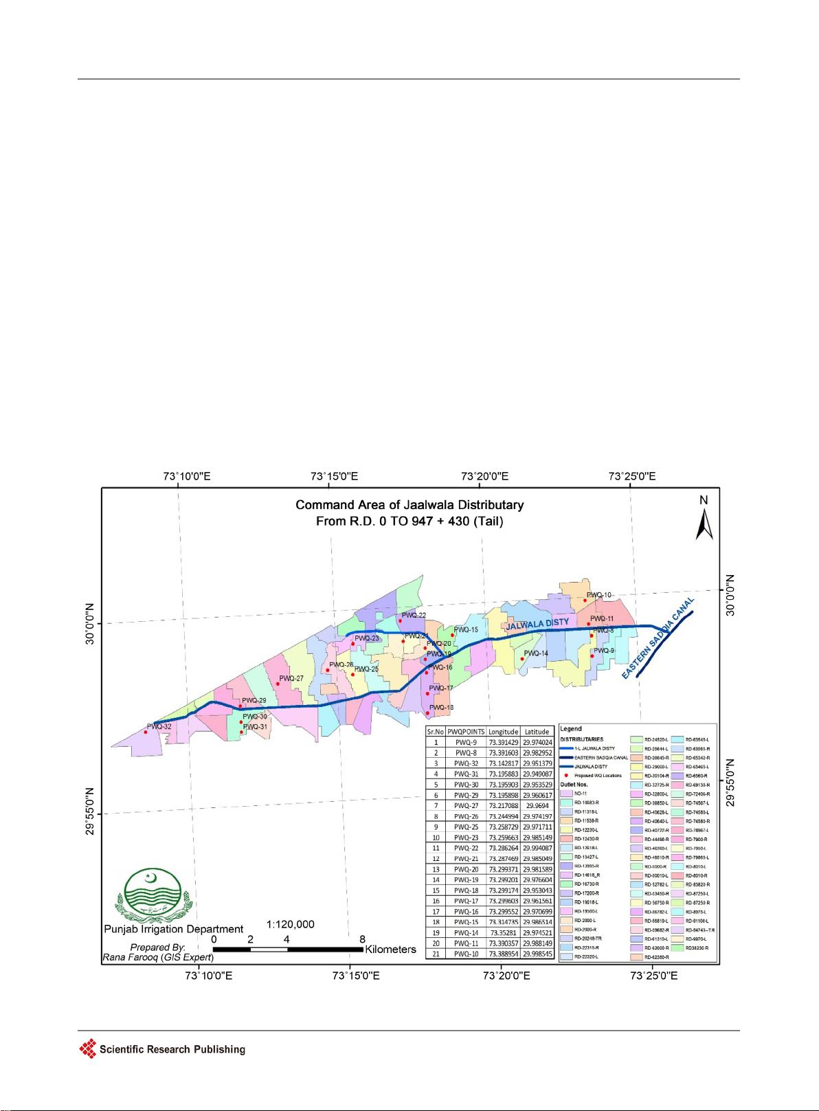
Jaalwala Distributary
was selected to see the consequences of concrete lining
on the underlying saline groundwater table. Its middle and tail portions were
concrete lined whereas the head portion was still
unlined. Visual MODFLOW
2011.1 was used to simulate the effects of concrete lining on saline groundw
a-
ter in two-
dimensional format. Simulation results showed a gradual rise of
electrical conductivity (EC) up
to 7000 µS/cm and decline in water table depth
to nine feet (2.74 m). It observed negligible in
flows from the distributary
through its western boundary due to formation of a permanent barrier in the
way of seepage of any kind. Results have f
urther predicted that freshwater
layer available beneath the Jaalwala Distributary (before its lining) will fi
nish
ultimately and the below present saline water also move upward to take this
vacated place. Hence it was
concluded to line the canals of saline water areas
from their sides which will not only protect them from erosion but canal w
a-
ter theft as well.
Keywords
Water Balance, Jaalwala Distributary, Saline Water Intrusion,
Hydrostatic Pressure and Interface
1. Introduction
Dependency of our lives on water cannot be overlooked. It not only exists on the
surface of the earth in so many forms but is also present below the lithosphere,
having linkages with each other [1]. Apart from natural activities, groundwater
was also restored artificially by surplus irrigation, seepage from man-built water
How to cite this paper:
Khan,
M.H.A.,
Saleem
, M.U., Ahmad, S.R., Ahmad, N.,
Sameeni
, S.J., Akram, M. and Farooq, M.
(201
7) Role of Canal Lining on Groundwa-
ter Fluctuations: A Modeling Simulation
Approach for Jaalwala Distributary, Bah
a-
walnagar
.
Open Journal of Applied Sciences
,
7
, 213-232.
https:
//doi.org/10.4236/ojapps.2017.75019
Received:
January 2, 2017
Accepted:
May 28, 2017
Published:
May 31, 2017
Copyright © 201
7 by authors and
Scientific
Research Publishing Inc.
This work is licensed under the Creative
Commons Attribution International
License (CC BY
4.0).
http://creativecommons.org/licenses/by/4.0/
Open Access


剩余20页未读,继续阅读
资源评论


