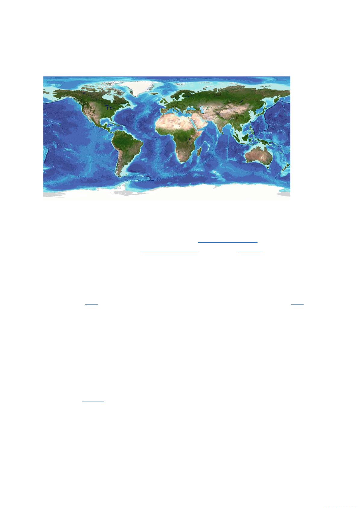
The grid uses as a ‘base’ Version 2.4 of the SRTM15+ data set between latitudes of 50°
South and 60° North. This data set is a fusion of land topography with measured and
estimated seafloor topography. It uses predicted depths based on the V31 gravity model
[Sandwell et al., 2019]. This version of SRTM15+ is similar to version 2.1 [Tozer et al.,
2019] but also includes:
• data from 905 new multibeam sonar cruises, archived at the US National Centers for
Environmental Information.
• nine large composite grids from IFREMER for the Gulf of Aden (Hebert et al., 2001),
the Lesser Antilles volcanic arc (Talbot & Loubrieu, 2020), French Guiana margin
(Loubrieu, 2019a), the Rodrigues triple junction (Mendel et al., 2000), the Kerguelen
plateau (Loubrieu, 2019b), Reunion island (Sisavath et al., 2011), Saint-Paul and
Amsterdam Islands (Loubrieu et al., 2020), the Southwest Indian ridge (Sauter &
Mendel, 2000), and the North Fiji basin (Ruellan, 2001).
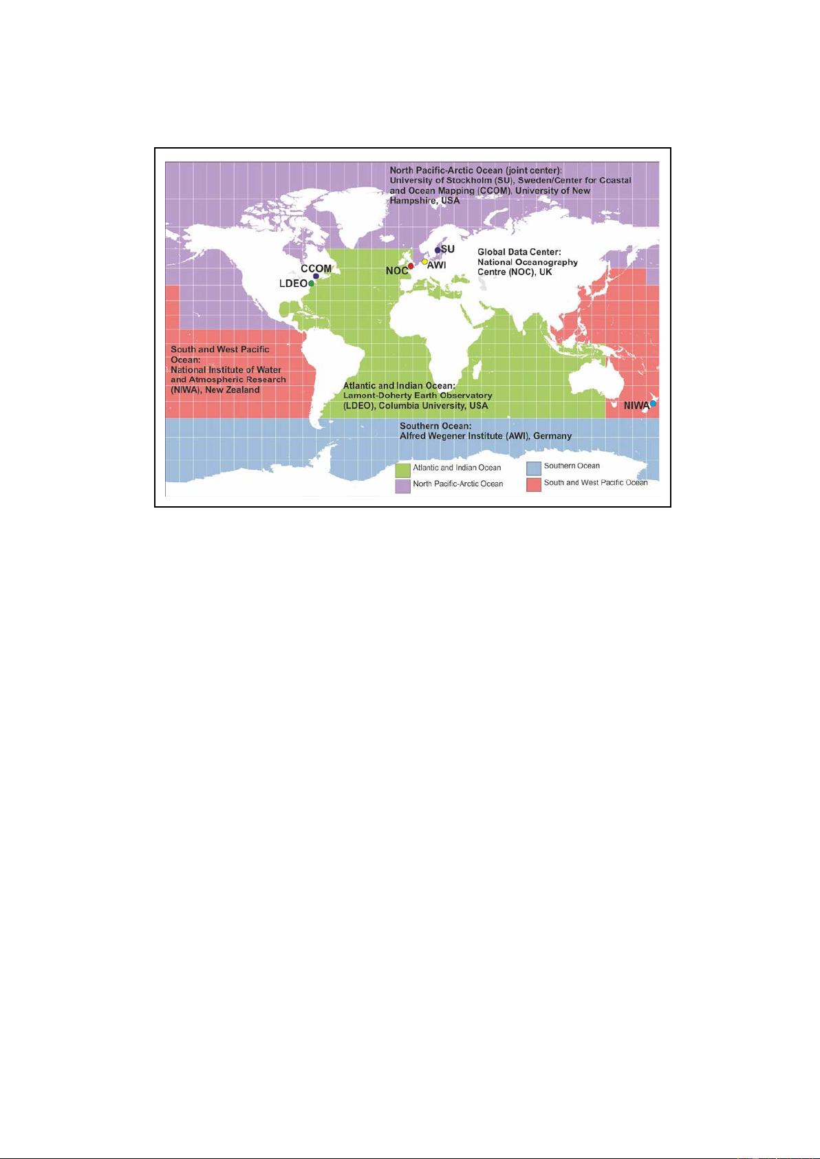
The SRTM15+ base grid has been augmented with the gridded bathymetric data sets
developed by the four Seabed 2030 Regional Centers to produce the GEBCO_2022 Grid.
The Regional Centers have compiled gridded bathymetric data sets, largely based on
multibeam data, for their areas of responsibility. These regional grids were then provided to
the Global Center.
For areas outside of the polar regions (primarily south of 60°N and north of 50°S), these data
sets are in the form of 'sparse grids', i.e. only grid cells that contain data were populated. For
the polar regions, complete grids were provided due to the complexities of incorporating data
held in polar coordinates.
The compilation of the GEBCO_2022 Grid from these regional data grids was carried out at
the Global Center, with the aim of producing a seamless global terrain model.
For the 2020 and 2021 releases of the GEBCO grid, the data sets provided as sparse grids by
the Regional Centers were included on to the base grid without any blending. This led to
discontinuities at the boundary between the regional grids and the base grids in some areas,
largely in regions where the base grid is not constrained by measured data, i.e. areas of large
differences between the data sets.
For the 2022 Grid, the sparse regional grids have been included on to the base grid using a
‘remove-restore’ blending procedure (Smith and Sandwell, 1997; Becker, Sandwell and
Smith, 2009 and Hell and Jakobsson, 2011). This is a two-stage process of computing the
difference between the new data and the ‘base’ grid and then gridding the difference and
adding the difference back to the existing ‘base’ grid. The aim is to achieve a smooth
transition between the 'new' and 'base' data sets with the minimum of perturbation of the
existing base data set. However, please note that there may be differences between the 2022
and 2021 grid in regions outside areas of measured data due to the grid merging process.
For the polar data sets supplied in the form of complete grids these data sets were included
using feather blending techniques from GlobalMapper software version 23.1.0 made
available by Blue Marble Geographics.
Some additional edits were made to the final grid to remove erroneous values identified in the
previous grid and notified to the Global Center.
The GEBCO_2022 Grid includes data sets from a number of international and national data
repositories and regional mapping initiatives. Information on the data sets included in the grid
is given in our data contributors list.