Idrisi =
地理信息系统(Geographic Information System)+
遥感图像处理(Remote Sensing Image Processing)
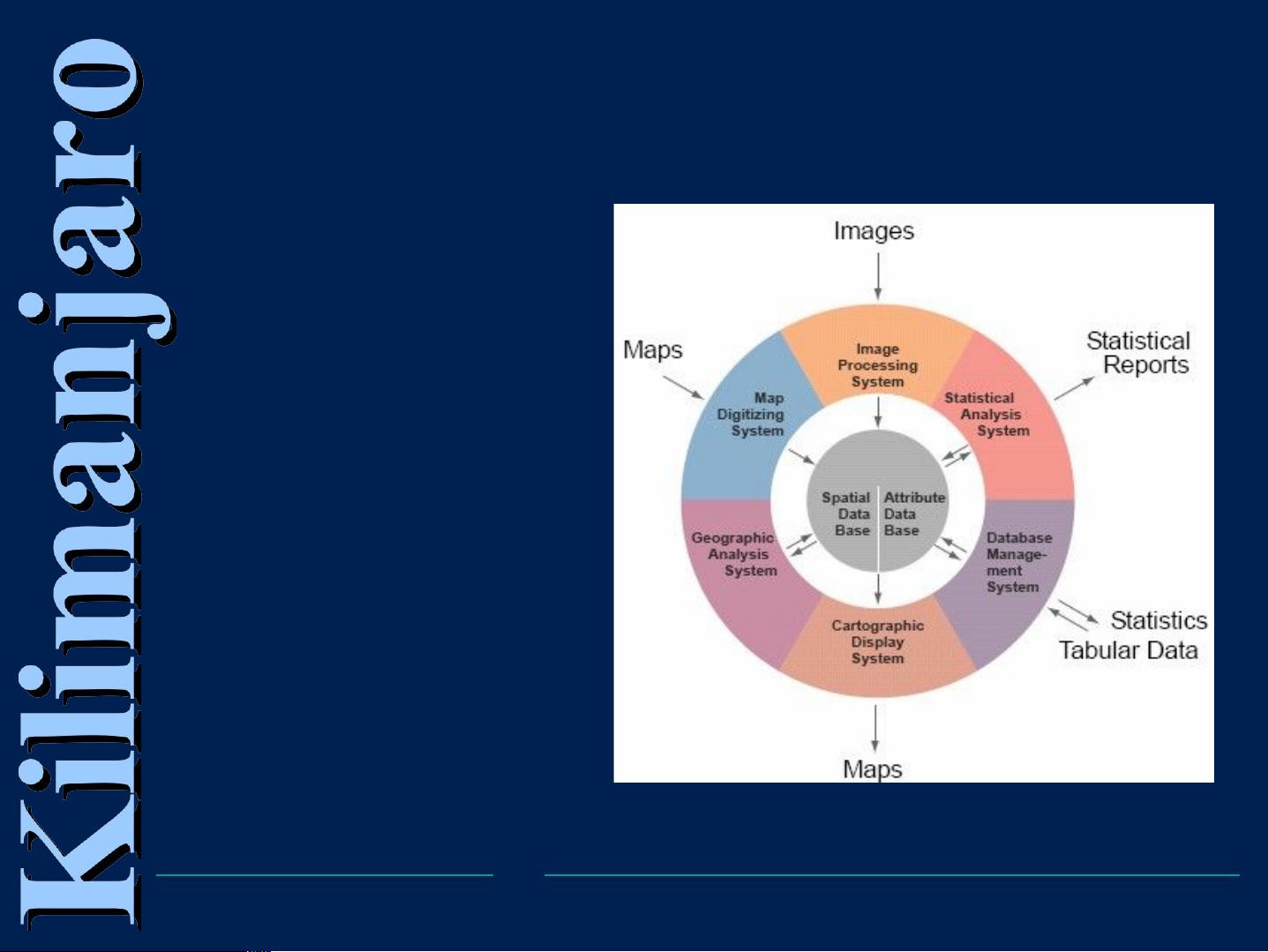
地理信息系统结构
The Structure of
Geographic
Information
System
IDRISI 迄今已开发了 14 个版本,相关信息详见:
http://www.clarklabs.org 或 http://www.environ.pku. edu.cn/env-irc/env-irc.htm


评论5