Raster data operations in DotSpatial~ Tutorial (3)
Purpose of this assignment: Become familiar with the following raster operations in DotSpatial:
1. Loading different formats of raster data in DotSpatial.
2. Implementing the hill shade.
3. Change the color of the raster data.
4. Multiply the raster data.
5. Reclassify the raster data.
6. Get the mouse clicked point values on the raster data layer.
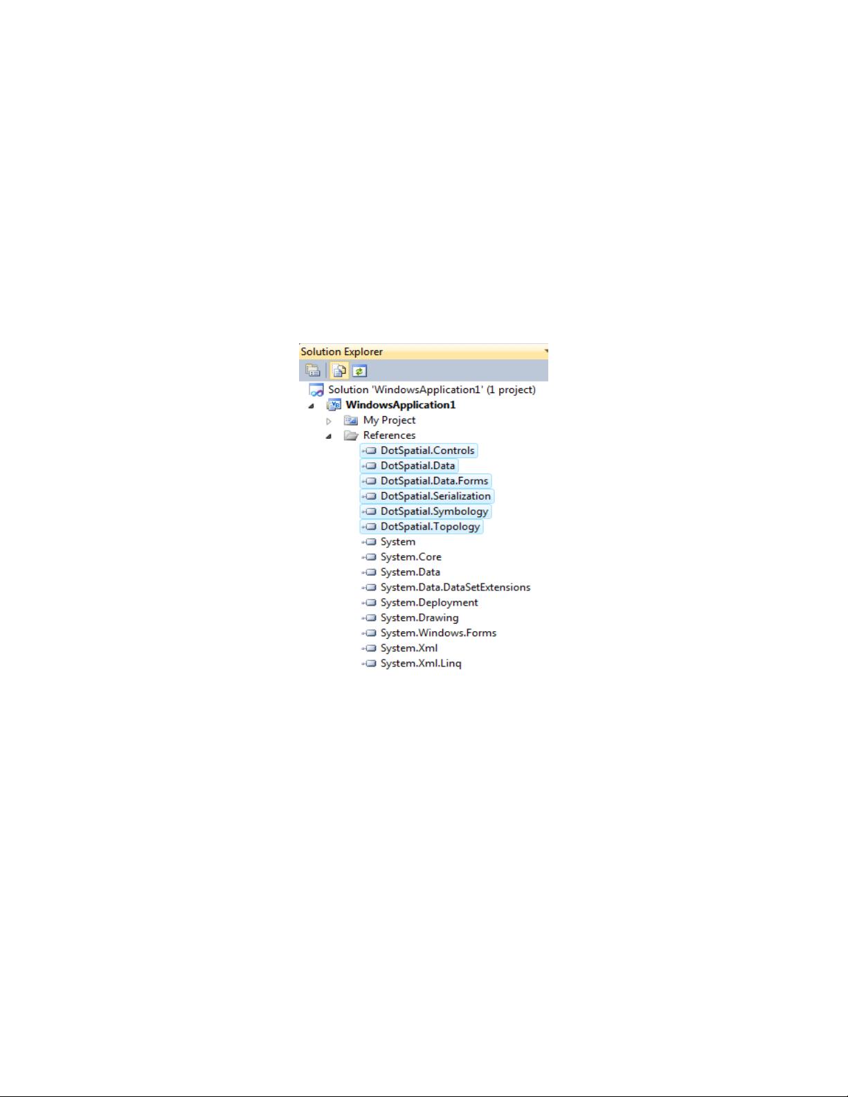
Step 1: Add the DotSpatial reference and change the compile option.
1.1) Adding the references.
DotSpatial.Data.Forms.dll, DotSpatial.Symbology.dll, DotSpatial.Controls.dll, DotSpatial.Projections.dll,
DotSpatial.Data.dll, DotSpatial.Topology.dll
Fig. 1 Required references.