


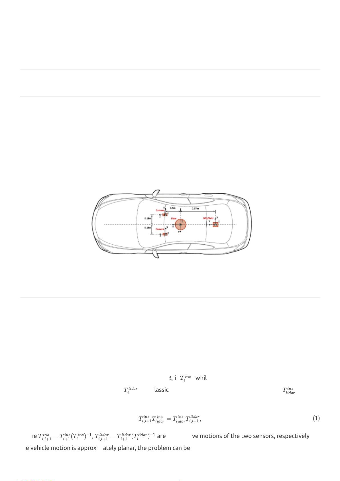
Apollo's Coordinate System
You are welcome to join t h e Apollo develo p m ent. In Apollo, it involves all kinds of different
coordinate systems as an autonomous driving system. In this manual, we discuss the definitions of
these coordinate systems we use in the Apollo project.
1. The&Global&Geographic&coordinate&system&
In Apollo, we use a global geographic coordinate system to represent the geometric position of the
elements in the high-definition map (HD Map). A common choice of the global geographic coordinates
is latitude, longitude, and elevation. In Apollo, we use WGS-84, the World Geodetic System dating
from 1984, as the standard coordinate reference system for representing latitude and longitude of
objects. By using this standard coordinate reference system, it is possible to uniquely identify any point
on the Earth’s surface – except the North Pole – by two numbers, the x- coordinate and the
y-coordinate of the point, where x corresponds to the longitude and y to the latitude.
WGS-84 is popularly used in GIS service, such as mapping, positioning, navigation, etc. The definition
of the global geographic coordinate system we used is shown in the following figures. The elevation
value is defined as the ellipsoidal height.
2. The&Local&Frame&–&East-North-Up&(ENU)&
In Apollo, the definition of the local frame is as follows:
• z-axis – pointing up (aligned with gravity)
• y-axis – pointing north


